Saturday, June 11, 2016

Cuivre River

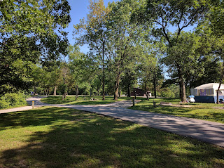
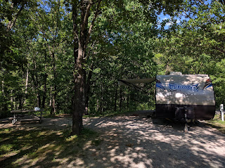
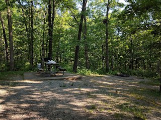
As I indicated in prior post, we spent 2 nights at Cuivre (pronounced quiver) River Campground outside Troy, Mo. Following our wonderful Goole map directions, we apparently took the shortest route in to the campground...and ended up lost at one of the many day use areas. Thank goodness a local policeman was driving through..and saved us. He said he was on his way to the beach area, where no alcohol was allowed and it was easy pickings, so we should just follow him and the campground was just above. And above was correct..we wound several miles into the Lincoln Hills (small mountains to Floridians) on a skinny, supposedly 2 lane road. Yes, we passed a beach area, ultimately 114 steps down from the campgrounds. We checked in, got situated in the site and decided we wouldn't be running to town for anything we didn't have.
The park began in the 1930s as a federal recreation demonstration area when workers from the Civilian Conservation Corps and the Works Project Administration constructed roads, bridges, group camps, and a picnic shelter. Two historic districts within the park, the Cuiver River State Park Administrative Area and Camp Sherwood Forest, were added to the National Register of Historic Places in 1985. The state took possession of the park in 1946. There are trails everywhere, from 1/2 mi  to 5+ miles and nothing is flat.
The check in station had a little store that sold a few supplies, ice, ice cream and firewood. We didn't avail ourselves of the firewood but did buy ice and of course, ice cream. Snickers ice cream bars are worth every penny! Additionally, we did laundry, used their showers and pretty much stayed in the campground.
Friday we got up early and came down that skinny, winding park road before all the weekend traffic met us coming the other way. 

The uneventful drive up US 61 ( not an interstate...yet) and 218 got us to Iowa City about 12:30. We found the Tailwater West campground, part of the Coralville Lake Dam Complex..of course not without at least one wrong turn...and words..and settled in.  We had to get some groceries so spent time chatting at the visitors center to get lay of the land. As a result, found out way to a new store..Hy-Vee.
Hy-Vee is Publix, Fresh Market and Whole Foods rolled into one..with a Starbucks and Bar & Grill. It's the perfect place per Bruce..I can grocery shop while he sits at the bar in the Market Grill and has a beer. We even went back for dinner...handmade and cooked to order burgers were buy one get one 1/2 price. They were definitely some of best I've ever had.
Well, getting dark here and shower time. More later...Au Revoir mes amis.
Thursday, June 9, 2016

Look up in the sky. It's a bird. It's a plane......

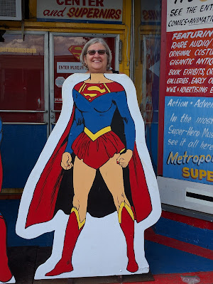
It's SUPERMAN! We just spent the last 3 nights camping in Ft. Massac State Park, located in Metropolis, Il...the official home of Superman. There's a big statue of Superman in front of the Courthouse downtown (yes, I did cut off the top of his head) and all things "super" related everywhere(Supergirl is looking pretty good don't you think, even with a double chin and gray hair!) In fact, Metropolis is just getting ready to hold it's 38th Annual Superman Festival and their 9th Annual Superman Film Festival, starting tomorrow, June 9th. Beautification was occurring everywhere you looked. The carnival had already set up the rides and games and many of the vendors had already joined us in the campground, so we got to enjoy watching them arrive.  Looked like the Festival was all set to be quite the extravaganza.  One vendor said he thought the local supermen were the best part... men with quarter to full bellies sporting "sprayed on like" Superman suits... and that the parade was wonderful, with villains and superheroes of both sexes strutting their stuff. I think we may seriously plan to attend next year.
Superman aside, Ft. Massac is a beautiful park. It became Illinois's first state park in 1908. Built by the French in 1757 and originally called "Fort de L’Ascension,"  the name was changed to Fort Massac, after a French Naval Minister, in 1759 . After the end of the French and Indian War in 1763, it was abandoned by the French and then burned to the ground by the Chickasaw. Only a charred ruin remained when the British arrived to take possession and they never rebuilt. In 1778, during The American Revolutionary War Col. George Rodgers Clark led his regiment into Illinois at the abandoned site, surprising the British. In 1794, the fort was rebuilt by order of General Washington and for 20 years protected U.S. military and commercial interests in the Ohio Valley.  It was damaged in the 1812 New Madrid earthquake, rebuilt to play a minor role in the war of 1812, abandoned again in 1814 and finally succumbed to defeat as the local citizens dismantled the fort for its timber.  The original site is still visible, although a detailed reconstruction of the 1802 fort was built in 2002 and can be seen today. Each fall, reenactors gather for the Fort Massac Encampment, which interprets life in the 18th century. So the park has a full history. What is really impressive though, is the number of local residents, in a town of only 6500, continually using the park for picnics/get-togethers, recreation, exercise, dog walking, etc.  Guess we've just never stayed in a park so close to the community to observe the every day goings on. and it is really nice. They definitely love this park.
The campground is older and smaller, but very peaceful. Water is centrally available to fill your camper but not to hook up permanently, 30amp service is on all sites, with a few even supporting 50amp service. Sites are grassy, shaded and well dispersed around two circles, so privacy is assured. There are walking and biking paths, the inevitable boat ramp... directly into the Ohio River...day use facilities, a visitor's center, and trees every where. Just across the street were Sonic, a bbq place, a chinese/pizza buffet(extremely good BTW) and a Mexican restaurant with a full bar. We couldn't really ask for more and I really, really enjoyed our time there.
So what else happened you ask...well we spent most of Tuesday morning looking for a place that would repair the Tahoe AC, and most of yesterday morning getting it repaired, thank goodness. And conveniently, the repair place was just 6 blocks up the street from the National Quilt Museum in Paducah, so I spent a relatively stress free morning there. Lunch in a local bakery ended our time in Paducah, with nothing more than a postcard purchased. I'm proud of myself...no fabric!
Left eary this morning for Cuivre River State Park, just outside Troy, Mo (NW of St. Louis). We're here for 2 nights and based on the road up here to the campground, (think our house on the mountain in Italy Maggi) we won't be going anywhere tomorrow except outside to enjoy nature. Not looking forward to the trip back down Friday morning, but we'll manage.
Au Revoir mes Amis!!!!


Sunday, June 5, 2016

Piney Grove Campground


Arrived at Piney Grove Friday around 2pm after leaving Deerlick around 9. Drove the back roads, most on US 43 in all it's combinations, except for a 25 mile stretch on I-22 trying to beat the rain. That really was for naught, because there were still campers in our reserved site when we arrived so it was 3:30 before we set up...but still ahead of the rain by about an hour or so....wle had time to enjoy an adult beverage by the lake. Then it was get Hazel's thundershirt on, eat dinner inside and spend the evening reading.
The campground/recreation area, situated between Tishomingo and New Site, MS, pretty much takes up most of one of the peninsulas in Bay Springs Lake...with the campground at the southern end and our campsite (117) actually on the SE tip. We're facing the Natchez Trace Recreation Area across the lake.  This man-made lake is one of the COE projects on the Tennessee-Tombigbee Rivers. Most of these campgrounds were originally built to provide COE housing for the people building the dams.
The Tennessee-Tombigbee Waterway extends 234 miles from the Tennessee River to the junction of the Tombigbee River in Alabama. The man-made waterway connects commercial water transportation with the Gulf of Mexico. 
The system includes ten lock and dams, Bay Springs Lake, Gainesville Lake, Aliceville Lake, Columbus Lake and Aberdeen Lake. Overall, the Tenn-Tom waters cover 180,000 acres of public land.
Spent Saturday with on and off rain. Good day to eat all the leftovers in frig, drink wine and finish that dang blasted jig saw puzzle...and we did!
Now we're on the other side of Paducah...at Ft. Massac State Park. More on that next time.