Tuesday, May 14, 2013

Homolovi Ruins

Every time I said Homolovi while we were planning our trip, my pronunciation was short O, long O, short O, short I (e). I would imagine we were in the movie The Mummy and would be in Egypt. Wrong place , the correct Hopi pdonunciation is Hoe Mole' ve, with emphasis on second syllable. Much more Native American.

The ruins are exatly that -ruins. They have excatated 4 different sites, I-IV, but only I & II are open to the public, and only II, has much to see. They are on State Trust Land, and were pretty much decimated by people looking for artifacts before the Park system got involved or there was any offical archeology performed. The ruins at II include a stabilized 5 room dwelling, a kiva and what would have been an underground common room. The rest of what would have been an 1100 room community that may have housed about 1200 people lies in rubble clustered around circular "artifact search" holes.  Some of the pieces of pottery recovered by the archeologists is on display in the park's visitor center.II is ADA accessible by a 1/2 mile paved trail (walk one of the day)  

The ruins at I afe barely visible and ne,t to the Little Colorado River. Interesting fact, even when that river bed seems dry, there is water 3 feet down. One of the reasons the ancestral Hopi people probably came down from Second Mesa to this area, both to live for generations amd then once they left, to return periodically.

We are on our way nofth from Flagstaff snd I want to post while I can so will stip now. May be awhile before I can post agian since have no idea of.connectivity in Grand Canyon.  Later..

Monday, May 13, 2013

Standin' on a Corner...

In Winslow Arizona, such a fine sight to see... part of the classic and still popular lyrics of the early 70's #1 song by The Eagles, Take It Easy. Surprisingly, the lyrics were not written by any of the band, but by Jackson Browne, a good friend of Glen Frey, who wrote the music. Apparently the line about Winslow is a true incident that happened to Browne a few years prior and he memorialized in the song. It has also been memoralized in Winslow on historic Route 66 in Standin' on the Corner Park.  Featured are a life-sized sculpted  bronze balladeer with a guitar, AKA Easy, created by Ron Adamson, a real flatbed ford, and a trompe l'oeil style mural by John Pugh painted on the brick wall behind Easy of store windows reflecting "Its a girl my lord in a flat bed Ford, Slowing down to take a look at me."  Fun, fun, fun...even took a campy picture to prove I was, wait, wait...it's coming... Standin' on a Corner in Winslow Arizona.

The other two places we visited (besides the Walmart of course) were the Hubbell Trading Post, now the Winslow Visitor's Center, and La Posada Hotel. Well you ask, what is so great about those two places.

The Visitor's Center is in what used to be one of John Hubbell's Trading Posts on Route 66. It has all the original floors, the tin roof, the old wooden elevator and two safes - one for pawn items and one for money.  John Lorenzo Hubbell was one of the most respected and well known Navajo traders of his day. He was considered a true friend by the Navajo because of his honesty in business dealings and his wise counsel to them. He acted as both their merchant and their liaison to the rest of the world. The original Hubbell Trading Post located in the Navajo Nation near Ganado, AZ still operates and is now a National Historic Site.

La Posada Hotel is the last and most elegant of the Fred Harvey Hotels built by the Santa Fe Railroad. It was designed by Mary Colter, the same Mary Colter of Grand Canyon fame, when she worked for Fred Harvey. Fred Harvey hired her as chief designer and architect for his company in 1910. That was an amazing accomplishment since women couldn't even vote for President until 1920.  For La Posada, she designed the buildings, decorated the interiors, planned the gardens and oversaw construction.

Fred Harvey brought civilization to the west via the Santa Fe Railway. He developed and ran all their hotels and restaurants. He introduced linens, silverware, china, crystal and impeccable service to railroad travel. He is very famous for his Harvey Girls.

La Posada was the last great railroad hotel. It opened in 1930 and was rumored to have cost $2 million (about $40 million in today's $.)  All the passenger trains from LA to Chicago stopped there and everybody who was anybody stayed there. Until about 1950, Winslow was the big town, even Charles Lindberg designed their airport. But then rail travel dropped off, people were in too much of a hurry for that type of travel. It became planes and automobiles. For a while La Posada was the finest hotel on Route 66.  By 1957 though, Route 66 had been bypassed and shut down and La Posada was closed and nearly torn down. But it wasn't. For a time in the 60s it was gutted and made into offices by the Santa Fe Railroad. Then they abandonded it. In 1997 it was purchased by 4 people, using grant money and private investments. They have been restoring it little by little and there is a treasure trove of history available in the rooms open to the public. It is again open as a hotel and is on the National Register of Historic Places. It still fronts the railroad and you can still sit in the shade and watch the trains.

More tomorrow on our early morning at Homolovi Ruins.  Later....

Saturday, May 11, 2013

I did it, well almost.....

We were up early and at KKTR by 7:44 this morning, ready to hike through the canyon and climb to the mesa (yeah right.)  We were the first people at the Monument this morning and had the rocks all too ourselves. We walked the 1/2 mi to the Canyon cut off and decided to give it a try. Unfortunately, sun had not reached the canyon while we were there so pics are not as colorful as they could be, but I did get some.

With Bruce's help I was able to ,climb over the rocks in the trail and get through most of the canyon.  We stopped short of the last climb to the top with probably 100 vertical feet to go, but I will make it next time. The picture of me without a face is a Bruce normal, but it is truly me coming under the rock. So our first walk of the morning was about 2 mi round trip with an elevation change of about 500' up and of course back down. We then drove back to the Veteran's Memorial Overlook at 6500' and walked the mile trail around the mesa. After 3 ibuprofen and a snack of jerky and pistachios I felt good enough to come back to Tempy and sit in the sun and nap for awhile.  Boy, talk about a rough day.

We leave tomorrow for Homolovi Ruins State Park right above Winslow, AZ.  Plan to spend Monday in the park, seeing the ruins. Then Tuesday it is on to Jacob Lake and Wednesday the North Rim. We are getting everything put away now so we can leave right after Bruce's Huevos Rancheros breakfast tomorrow.  We want to get thete early since once we set up camp at Homolovi, it will be back to Winslow for groceries.  Don't think we will be running out to the convenience store once we reach the Grand Canyon.  So I will make this short and leave you with this last fact.

The waters of the Rio Grande River flow through Cochiti Dam without any slowing of the speed they  normally flow or any reduction in water volume unless there is the potential of flooding.

Friday, May 10, 2013

Kasha-Katuwe Tent Rocks National Monument

Kasha-Katuwe means "white cliffs" in the Pueblo language Keresan. Yesterday we visited the KKTR National Monument early in the day. The Monument lies on the southeastern edge of the Jemez volcanic field, a volcanic system that has been active for the past 15 million years. As a result of that activity over the years, the ash and sediment have fallen in layers so bands of grey/white are interspersed with pink and beige rock. Makes for a beautiful view of the weathered cliff sides. Add wind and water action and canyons and arroyos (deep gullys/dry stream beds) have been created, holes have been scooped into the soft rock and the ends of small, inward ravines polished into smooth semi-circles. This area is very much like the Moab area in Utah.

We walked the 1.2 mi cave loop trail around the base of the monument. It is labeled easy, but to me even that is questionable. The trail is sand, up and down hills starting at 5700' elevation to about 5900'. For a girl from 0' elevation, catching my breath was the worst part. When we reached the cut-off to the Slot Canyon Trail (1/2 mi into walk) I didn't even want to go the additional 300' to its start/rest area because I would have to come back and still do the other .7mi of the cave loop. What a wimp. One of the interesting things to see on the "easy loop" is a cave sitting above our reach that was used by ancestral Indians. Apparently they preferred their housing high to avoid animals, inclement weather, floods,, etc. There are obvious  smoke discolorations on the roof,{soot) indicating use for prolonged periods.  The real gems of the walk are the "tent" rocks, spires of soft pumice and tuff created by the volcanic activity, often topped with a mushroom hat. Where the hats are missing, the spires have begun to deteriorate.

Slot Canyon Trail is 1mi one way, up a 630' climb to the top of mesa. I am sure it is beautiful, but I sure wasn't ready for that activity yesterday. Instead, once we returned to the truck, we drove the additional 3.5 mi on the winding, gravel, uphill road to the end of the monument and Veteran's Memorial Scenic Overlook - which was definitely worth the bumpy road.

This small monument is a great place to visit and walk. As Bruce said, it is good for me to get out and get more fit. So, we are going back tomorrow morning, early since Saturday will be 71° and likely very busy at the monument as the day warms. I may not climb to the mesa, but I am definitely going to walk the slot canyon part. Hope to have some pics to share later.

Today we never made it to Bandelier, instead had a wonderful breakfast at the Stone Kiva Bar & Grill at the 18 hole golf course owned by the Pueblo de Cochiti. Huevos rancheros with pintos, hash browns, eggs om over flour tortillas and covered in cheese and some of the best homemade green chili we have ever eaten. Bruce could not get the recipe or even get them to sell him some. Seems we may need to visit again Sunday before we leave so he can try again.  We picked Hazel up from the camper and drove to the other side of Cochiti (emphasis on CO) Lake to visit the Tetilla Peak Campground. It is  quiter, older and only 30amp service but the view across to our side includes the rock ridge that surrounds the lake. All of this property is part of the Pueblo de Cochiti, with the COE taking care of the dam and recreational areas in trust for the Cochiti. We will be back to stay in this area again and probably at this camground.

Laundry called this afternoon and then because the park will be full this weekend, I decided on an early, leisurely shower while the bath house was empty and there was still plenty of hot water. Bruce may regret waiting, although he has already complained to me that he thinks they give the female side of the bath house preferential treatment and most of the hot water so it won't matter.

Enough of my ramblings for today. Later....

Wednesday, May 8, 2013

Its another dam site.....

We arrived at Cochiti Lake early this afternoon (MDT), set up on our nice rim site, fed ourselves leftovers and then went exploring. Cochiti Dam, is one of 4 COE dams built to manage flood and sediment on the Rio Grand.  It is one of the 10 largest earthen fill dams in the US and is the 11th largest in the world.  The dam is located within the Pueblo de Cochiti Reservation. Hope to make it to the Visitors Center tomorrow or Friday to learn more. 

We intend to visit the Kasha-Katuwe Tent Rocks (KKTR) National Monument and even do one or more of the hikes. We drove out today but found out that because it is on BLM land, no dogs are allowed and Hazel was with us. I had never had that happen before but it is probably because KKTR has been designated an Area of Critical Environmental Concern.  More on that area once we visit.

We had thought some scenic driving around Taos might be in order, but the weather is perfect for visiting some of the ancient Indian ruins so we may save Taos for another trip and instead run up to Bandelier National Monument.
I am definitely in a ldarning mode on this trip.

Will leave you with a few pictures of the area.  And yes, we did have to work on getting level on our site, as evidenced by all the blue leveler blocks under the tires.  Later....

Tuesday, May 7, 2013

No Man's Land..

Fort Supply was originally called Camp Supply or camp of supply. It was established Nov. 1868 to supply General Sheridan in his winter campaign against the Southern Plains Indians.  By 1890 the Indian wars were over so Fort Supply was officially closed in 1894.

In 1908 Oklahoma's first insane asylum was established at the old post and is still there, but now called the Western State Psychiatric Center. In 1988, the state legislature designated the remaining buildings at the old fort as the Fort Supply Historic District and 5 are being restored by the OK Historical Society. Additionally,  the William S. Key Correctional Center was opened at the site.  Although we were unable to tour the site while in the area as it is only open Tues-Sat, we did get a reaction from the correctional part when we pulled to the gate to look, I guess because there were inmates out and about. As we turned around and left, a white van came speeding towards us but we will never know what they wanted...maybe they just had info to share.

Today we are heading into the Oklahoma Panhandle, driving west out of Fort Supply into No Man's Land, on what, in our opinion, are the worst roads we have driven to date.  The land out here is what I would consider high plains. For any of you unfamiliar with that term I have attached a picture. Ironically, The Who were singing I can See For Miles as I took this picture. This is what you can see for miles and miles and miles....

This part of Oklahoma was originally part of the Texas Territory, but when Texas applied for statehood as a slave state in 1845,  US law said there could not be slave ownership north of the 36° 30' parallel.  So under the Compromise of 1850,  exas surrendered the 170 miles along the 36°30° parallel that is now OK.  At the same time, the eastern edge of New Mexico Territory was established as the 103 meridian so the "surrendered" area became "The Public Strip", part of no official territory.  Unofficially it was called No Man's Land.  It was not surveyed so could not be homesteaded, only "squatted." It had a brief history trying to become the Cimmaron Territory and twice petitioned to make that official, but in 1890 No Man's Land was assigned to the new Oklahoma Territory.  Interesting how that little strip called the Oklahoma Panhandle came to be.

Well, we are now in New Mexico, staying the night at Ute Lake State Park. Tomorrow we are off to Cochiti Lake, outside Santa Fe, NM. Never having been to Santa Fe or Taos, we are looking forward to those 4 days. More later.....

Saturday, May 4, 2013

We will resupply...

First off - Gene Autry's horses' names were Champion. There were 5 Champions, and the last ones were known as Champion, the World's Wonder Horse.

Now to what we have been doing - we spent the last few days in Edmond, OK enjoying a delightful, but cold and windy visit with my sister and her husband. Stayed (slept) right around the corner, literaly, from them at Arcadia Lake in Scissortail campground. This campground, as well as the lake and its other surrounding recreation areas, was originally developed by the Army Corp of Engineers in cooperation with the City of Edmond in 1987.  And although it definitely appears aged, location and price won out, especially since we spent most of our time at my sister's place, leaving just this morning.

We drove across Oklahoma and just arrived at Supply Park at Fort Supply Lake in northwest Oklahoma.This is another older COE park, built in conjunction with the dam and lake in the early 1940s . This is the 6th largest earthen dam in the  US, built for flood control and conservation.  The campgrounds within Supply Park run along the edge of the lake and provide multiple areas from which to choose.  Our site has a nice view of the lake and is somewhat protected from the wind and although we have a paved site, it is very unlevel side to side. It took 3 courses of our leveler blocks to get somewhat happy with our set up. The sites are small, many unlevel, the landscape is high plains and the bathrooms are vault toilets in conjuction with 2 newer bath houses and that is for over 90 sites.  Needless to say, with just 3 nights, we will be using Tempy for showers, etc. Even with the age though, the campground is pretty full. Seems many of the campers come from the oil fields to enjoy the lake in their spare time.

We will explore Woodward and Fort Supply over the next two days, as I am sure you are all anticipating some fabulous history from this area. Now it is toddy time.  Until then, later.....

Monday, April 29, 2013

Back in the Saddle Again....

OK all you oldie but goodies - who was famous for that song? Give up? Gene Autry. Well, Bruce and I found the Gene Autry Museum yesterday in, guess where......Gene Autry, OK, imagine that.  We were returning from Winstar Casino and decided a side trip was in order. Unfortunately it was not open so we did not have a chance to visit. Probably a good thing since Winstar had already suceeded in liberating several 20s from my wallet. Anyway, instead we returned home to an almost empty "C" loop and got to enjoy the sounds of night without people.  What a deal!!

But I know what you are really waiting for is our latest history lesson. Now no grimaces, at least you aren't required to read this and there won't be a test.  The Chickasaw National Recreation Area was created in 1976 when the 6th oldest national park, The Platte National Park, was combined with the Arbuckle Recreation Area and its 2300+ acre lake, along with additional lands to create a new 10,000 acre recreation area.  But what started the whole national involvement and who built the infrastructure?

It seems people have probably lived in this area of "springs" for thousands of years. The Wichita, Caddo, and other Indians believed in the healing properties of the sulpher and bromine mineral waters, came and stayed. Then in 1800s the government began moving Indian tribes from east of the  Mississipi including the Chickasaw and Choctaw to this area. In 1855 the land that is now part of the recreation area came under control of the Chickasaw Nation. The town of Sulpher Springs grew in 1890s to the north of the mineral springs and the Indian lands, with hotels and bath houses promoting the medicinal qualities of the waters. The Chickasaw and Choctaw, along with many concerned town residents began to fear that uncontrolled use would destroy the waters so they worked with the Federal government to save the springs, one of our first real conservation efforts to protect for the future? The  Chickasaw and Choctaw nations sold the springs and 640 acres to the Dept. of the Interior in 1902 & the area became Sulfer Springs Reservation. In 1906 it was expanded and became Platte National Park. Then in the 1930s,  as part of The New Deal (which president was responsible for that legislation? - think back now, use that history you learned) the Civilian Conservation Corps (CCC) built pavillions, roads, trails, waterfalls and planted over 500,000 trees and shrubs. This link provides wonderful information, original plans and pictures and history for anyone interested.
www.nps.gov/nhl/Fall10Noms/ Platt.pdf 

In 1966 the Bureau of Reclamation built the dam and created The Lake of the Arbuckles. It now makes up the western edge of Chickasaw National Recreation Area. There is plenty more to learn about this area and if you enjoy fishing, this is supposedly the best bass lake in Ok. So make a trip out, enjoy the lake, the casinos and the park.

Oh yeah, and I leave you with this question. What was the name of Gene Autry's horse? Silver - no that was the Lone Ranger, Trigger - no that was Roy Rogers, Mr. Ed - come on now, a talking horse?  No looking it up on Google either.  Later....

Saturday, April 27, 2013

Chickasaw National Recreation Area - Buckhorn

We arrived at Buckhorn Campground in the middle of confusion Thursday. Remembering our commitment on this trip to be more spontaneous is not always easy as indicated by the fact we agonized over where to go after Jefferson and reviewed available campgrouds with potential sites online before making up our minds on direction. OK, not entirely spontaneous I agree, but it's a start.  Knowing we could not usually make an online reservation (yes we still like reservations around weekends) earlier than 2 days in advance, I had used Friday as our arrival day and then checked potential sites to see if they were occupied Thursday, thinking it unlikely anyone would take a reservable site for one night if others were available. That would hopefully allow us to occupy it Thursday as a walk-in (spontaneous - right?). Finding one we liked, we made a reservation Friday - Tuesday. Since this park indicated it was open year round, we assumed all was well.  You know what assume means, right?  We got here to find that loop "C"" where I had reserved our site was closed and not scheduled to open until Friday, you know, the day of our reservation. Whoops, must have missed that little piece of info, even though I was sure that the site I had chosen online had been labeled with a W for Thursday, (arrival day) indicating it could be rented as a walk-in for that night. Anyway, it was not available, that loop was closed, there were no rangers around (in person or by phone) to open it early , even though the maintenance guy we found said it was ready, etc., etc.  At first blush, we panicked.  How could they say this campgroud was open all year? You guessed it - "D" loop (not even mentioned online on recreation.gov in the write-up ) was open, and was a first come, first serve loop.  It was a good thing that we had arrived mid-afternoon because there were still sites left where we could fit.  We found one where we could stay hooked up for the night, backed in and set up a temporary camp. Now knowing Bruce, you can imagine that by the end of that night we had met the camp hosts in both loop"D" and the soon to open "C", they had commmited to opening "C" loop at 8 am the next morning to make it easy for us to move as well as opening the bath house early and we had reviewed our reserved spot in C and located all the cut wood to collect.  All in all not a bad ending to an "assumed" arrival fiasco.

After coffee Friday morning, we moved, got set up and had gathered all the wood we might want by 10 am. We went into Sulpher to get some groceries and look around.  Found a small but very good Chinese Buffet for lunch and of course overate, but that did ensure we didn't buy all sorts of goodies while grocery shopping, we could hardly even get the things on our list.  Sulpher seems to be a growing city. The old Artesian Hotel downtown has been completely rebuilt and there is a brand new Artesian Casino next door. Talking with the camp hosts, the hotel is already fully booked even though it hasn't even opened. There is a new Chickasaw Cultural Center with programs and displays and all the small businesses seem to be getting facelifts. Tell me there isn't money in Casinos and recreation. And no, we have not been in the Casino yet but probably will check it out Monday. Came back to campground in time to enjoy the arrival of most of the weekend campers, both experienced and new to backing in and leveling trailers as well as putting up tents. Hint: Always get to your campsite early so you can observe the activities not be the main attraction.

As a final comment on the campground, we have to say that we are both very impressed with all the sites in this campground and with the help of the voluteer hosts. This campground has by far the best facilities we have ever seen in a National Forest Service operated park. Most NFS campgrounds we have experieced never have electricity and usually only have community water, pit toilets and no showers.  Here there are electric (50 amp) and non-electric sites, flush toilets, showers, and large private sites with either paved camper pads or prepared tent areas.  Roads are all paved and everthing is well maintained. Thumbs up to Chickasaw National Recreation Area Buckhorn Campground. We will definitely return.  Later...history of the area (I know you can hardly wait.)

Thursday, April 25, 2013

Oklahoma, here we come.

Leaving Alley Creek this morning on our way to Oklahoma and the Lake of the Arbuckles in Chickasaw National Recreation Area. Apparently no cell service at campground so wanted to do a quick update. We will move on to Edmond to visit my sister Terrie next week with no real plans after that until May 15th and North Rim. We will be out and about the next few days and will add more. Until then, later....

Tuesday, April 23, 2013

Changing weather - back to Jeans...

Today was a beautiful shorts day, the kind of day we all love, not too hot, mild south wind and fluffy clouds in the sky. But now that has changed. Although we are enjoying tonight's fire in shorts, we have added jackets and that southern wind is now from the northwest.  Many of the fishermen here at the campground are bringing in their boats and awnings are being rolled for the night. Today's 80 will be 42 in the morning with a high of 62 and possible rain in the forecast. Guess tomorrow will be laundry day and we will be back to wearing Jeans.

Today's history info is about Lake o the Pines, where we are camped. The Corp built Ferrel's Bridge dam in Big Cypress Bayou in the 50's originally as part of the flood mangement plan for Red River Basin. The dam is concrete and earth and is about 2 miles long. The resulting 18,600+ acre lake is a reservoir that provides water for the surrounding communities as far away as Longview. As it was being built they added provisions for activities such as wildlife conservation, fishing, boating and camping, lucky us.  There are five COE campgrounds, multiple boat ramps and several recreational day use areas. 

So tonight we sit on this lake, enjoying the fire and a wonderful sunset with thanks we still have places like this available. I am even including a picture of me this time so you can see I am actually on this trip too. Later...

Sunday, April 21, 2013

Alley Creek's Perfect Site

Just a quick note , we have the best site in the campground (at least according to hosts) and a real miracle - 4G data, even in the camper. This will be a catching up and keeping up stay, yea!!!!

We drove backroads, mostly US 84, but in some places the roads beat both the camper and us to death. The 15 mi stretch of concrete going west from Natchez when you go through Vidalia, LA is a bi??h. We seriously considered finding the first direct route north to I-20 but persevered and things smoothed out (somewhat). Takes about an hour longer driving time to use backroads but the scenery is nicer and we are so tired of both I-10 & I-20.  Anyway, just an update since we are here, set up and the children fed so adult beverages are in hand.  Later....

A Day on The Trace and off...

Thursday we decided to ride north on the Natchez Trace parkway and view some of the history in this area. After a delicious (ok fast) breakfast at the closest McDonalds we hit US 61 to learn about Natchez Trace.  First stop, Emerald Mound - the second largest Indian Mound in the U.S. Eight acres, built by the ancestors of the Natchez Indians and used for all sorts of things, including human sacrifices, from 1200 to around 1730.   Stopping next at Mount Locust Inn and Plantation, we spent several

minutes with one of the volunteers getting the background before taking Hazel up to the restored inn.

Mount Locust is the only one of about 50 inns or way stations that remains on The Trace. It was the first the boatmen or "Kaintucks" came to on The Trace when walking back north from Natchez where they had sold their goods. These men floated flatboats down the Mississippi to sell their goods in Natchez or New Orleans. Since going on to the Big Easy would have added weeks or more to the trip, many elected to use Natchez.  Before riverboats, these men had to walk or buy a horse (at premium prices of course) to return to Nashville some 500 miles north. Most chose to walk and could cover 15-20 miles a day. That made Mount Locust the perfect first stop over.  For $.25 ($37-$40 in today's prices) they received corn mush and milk and sleeping arrangements on the porches and grounds.

In 1785, Mount Locust was a simple homestead but the growing number of travelers compelled the owners to turn their home into a "stand", a crude inn. As business prospered they added a four room, two story annex behind the house, considered a luxury not readily found on Old Natchez Trace. Unfortunately, by mid-1820's the steamboat and other roads pretty much brought an end to Natchez Trace and after 1825 the inn catered only to Natchez residents looking for rural solitude. Slavery was part of this Inn's history too, with the 1820 census listing 26 enslaved people at Mount Locust and by the mid 19th century as many as 51. The site includes a cemetary holding the remains of 43 enslaved workers as well as a separate burial area for the Ferguson-Chamberlain family.

The National Park Service has restored the house to it's 1820 appearance, with free admission and interpretive programs. You can visit both cemeteries and actually walk a short trail beside the house to the original Trace.  Definitely worth a stop.

After this it was time for lunch. Note to self in future - Have it with you. There are plenty of places to stop and picnic, but few place to find anything else. I am guessing you have figured we didn't think ahead - and you would be right. So we decided to visit the Windsor Ruins, off The Trace on 552 and then get lunch, making this a well thought out stop. Guess again. I took my eyes off the road for 2 minutes to look up info on the Windsor Ruins and we must have whizzed right by. Next thing we are in Port Gibson discussing food and thinking about going back. Again (surprise, surprise ) food wasn't readily available.  Looking for even snacks by then, we stopped at the local Citgo diner. We ended up sharing fried chicken of the day as our entree with a peanut butter cracker chaser, yummmm. Then we went back to look for those ruins. In retrospect, I can see why Bruce originally missed the small, overgrown sign and the narrow clay road leading into the woods but I was ready this time.  We both ended up pleased we had returned. All that is left of what was the largest antebellum house in Mississippi are the Corinthian columns but they are indeed impressive. The house and furnishings had cost $175,000 in the mid 1800s, it weathered the Civil War intact and was used by both armies, only to burn to the ground in 1860 as a result of a party goer's careless cigarette. All that remained were a wrought iron stair case now at Alcorn University Chapel and the impressive columns pictured below.

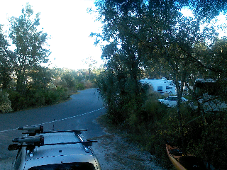
After all this running around (would you believe we didn't go more than 30 miles on The Trace) we headed back to camp, stopping for the requisite ice and ginger ale. We are currently being wimps inside Tempy with the heater on and drinks in hand. It is too cold with dropping temperatures (OK, it is only 59 but very windy) for outside social hour, even if we are inclined to spy on the rest of the arriving campers. Now to figure how to get this posted. Later....

It's 2 days later and we are off again to Alley Creek Campground, just outside Jefferson, TX.  Posting in arrears obviously.

Friday, April 19, 2013

Actually moving west...

We are currently camped at Clear Springs Recreation Area, outside Meadsville, MS, which is just east of Natchez.  This is a Forest Service campground on two levels situated around a small spring fed lake ( assuming a spring based on name.) If you have ever stayed in a forest service campground, they are usually pretty basic, with central water and no electricity. This one has site water and 50 amp service, several bathrooms with showers and flush toilets, and paved aprons at most sites. It is not a Corp park for you familiar with their usual amenities, but we are happy, especially for $13/night. They are only $20 if you pay full price, so still a deal.

Getting here hasn't been as wonderful though. We left Jacksonville to run into a big storm front passing eastward in Crestview. Hazel was really upset and spent most of the night in neurotic shaking frenzy.  If that wasn't enough, our killer fat kitty, Samantha had stopped eating. Since she has always been picky, we didn't pick up on it before leaving home and with a day of travel where she never eats, it wasn't until late Thursday we became concerned. One thing I was unaware of is that cats need to eat,unlike dogs and humans. If they go more than 48 hours they can develop something called fatty liver, which is usually fatal. We took her to vet Friday and after several tests and plenty of money, could draw no real conclusions, except she did not appear to have pancreatic problems or fatty liver. They sent us home with pills to increase her appetite and a recommendation to try Metamucil in case she was stopped up. She wasn't happy with either alternative, continued to refuse food, not just not eat. By Monday we had moved on to Pensacola and decided another vet visit was in order. This vet was more decisive and said looking at the pictures of the xrays I had snapped previously, whatever was wrong would most probably result in surgery. She was 15 and both Bruce and I were unwilling to put her through abdominal type surgery and the pain of recovery, if she could survive or recover, so we had her put to sleep. She is resting now not far from where she was born, at the house of our dear friends in Pensacola. Wolfy has been looking for her, but is adapting.

We left Pensacola yesterday and spent a delightful 5 hours driving the backroads to get here. We used US 84 across MS and were one of the only vehicles going west. Spent today in Natchez walking around and had lunch dowtown. City is full of history. Did you know this area used to be considered West Florida in the 1700's?  Decided to drive back to campground a different way and ended up "exploring" several backroads and as a result retraced our original route in once we located a familiar road.  We are now back at camp, Hazel and Wolfy are ready for dinner and I am trying to get this finished first, find the elusive data/telephone connection that floats with the wind and post. Later.....

Seeing as how I am posting today it is probably apparent I never could connect last night long enough at the bottom of the hill. We are now out and ready for a ride on the Natchez Trace so will have an opportunity to post this morning instead.   BTW, Verizon coverage everywhere is hooey. 

Wednesday, April 10, 2013

We begin...

We are off, on time and on schedule. Cats are riding in Tempy and Hazel is settled on her new perch in the back seat. Right now weather is clear and warm. It is a nice day for our first drive. Later.....

Thursday, April 4, 2013

Not much longer

I can definitely see us progressing towards departure date, next Wednesday I hope.  Tempy is being loaded, we have seen doctors, arranged for meds for 6 months, visited vet, secured animal meds for 6 months and of course have dealt with their food. You know they can't just be on Friskies and Ole Roy, no, we have them on special food of course and it always has special prices and places to secure.  Oh the days of just putting dog or cat kibble down and walking away.

Bruce has cleaned up the back carport and is currently trying to finish some work on the old Jeep still there. We managed to get all our assorted "stuff" in one of the garages so if the big winds come through, it is somewhat protected.

Still need to start the refrigerator in Tempy, pack food and finish deciding how much and what clothes will go. Bruce thinks 4 pairs of shorts, 4 pairs of Jeans and 30 t-shirts will cover him. Must be nice to be a man. I get the job of making sure the bath is outfitted, we have some trauma supplies, DVDs and books are available (we did buy a TV and DVD player), bills are paid, cable is on hold, food is packed, kitchen is supplied, paper products are covered, my clothes are packed, etc., etc., etc.  I think you get the point. Anyway, we are well on our way to being done.

Next post will be after leaving here and actually on our way to somewhere.  I will miss my friends during the trip but most of all I will miss my grandson.  I leave you with this picture of a delighted little boy last Sunday. Everytime I see it I have to smile. He will be so different when we return. But mom and dad will keep us in the loop with pictures I hope.  Later all ....

Friday, March 22, 2013

Truck Prep

I know everyone understands the need to ensure your vehicle is travel ready. Well, today we are immersed in that activity. We just picked up new toolbox for back of the truck. Bruce had it made to specifically fit behind the 5th wheel hitch, between the hitch and the tailgate.  It is 10" high, including the locking top. That is an important detail. We ordered a standard one before that was supposedly 10" high, but when it came in, guess what - add another inch for the opening top.  Needless to say, it went back.  Since we had it made, we could also get it deeper so now we have 22" instead of 18. Flat black of course, to match everything else in back.

I have been lounging in the truck outside Nimnicht GMC while Bruce buys fuel filter, oil filter and new air filter for last half hour. Guess what - those are not inexpensive for diesel, but better starting fresh than having to get service in Alaska.  And this way labor only requires beer for compensation. Only thing left I would like installed are window visors, you know those wind/rain deflectors over windows. Since newer vehicle doors all seem to slope inward at top, rain iis a real issue if you need to roll the window down for any reason. Finding ones that Bruce likes probably isn't happening. No to stick on ones at dealer, they go on the paint;  no to window track too, since makes track bow out. Guess we (that means me of course) will continue to look. I am not holding out hope that these will happen before we leave.

Now home for an afternoon of installation. Maybe we should stop for lunch since we are already out. We did eat breakfast out so too much?  Nah... Later.....

Tuesday, March 12, 2013

Driving and Snacking, Etc.

We all need treats when we drive long distances, right? OK, maybe some of you don't, but it seems as soon as we start a trip Bruce is looking for something to eat. This time we decided to try to manage that activity better, for both of us. I really don't want to return from this trip sporting even more weight.

Anyway, instead of peanut butter crackers and oreos, we are trying homemade beef jerky and pistachios, at least as a start. I imagine trail mix will work its way in too, but it hasn't yet. And yes, we will still have meat & cheese roll ups, boiled eggs, fruit, etc. in the cooler, but I don't consider those foods treats. Treats, for me, mean salty, crunchy and/or sweet. The jerky should cover salty and the nuts crunchy so that leaves sweet for me to find. The nature of jerky seems to include an automatic limiter, but I can easily overeat on nuts. To help limit those calories a little, as you can see, these still have shells. Yes, I know that is not much of an impedance since most are already open, but it is much better than being able to grab a handful and put the whole thing in your mouth at once. Talk about easy mindless crunching not even considering the calories.

The pistachios were purchased so we just needed to make the jerky. I can accept added salt on purchased nuts but am not too keen on all the stuff used in most commercial jerky s.  And have you seen the price?? They all certainly think each of their brands is something really special. For the cost of premade, with a little work on our part, we get all meat with known seasonings and nothing else.

This is a picture of our third batch cooking (dehydrating). First batch was made using flank steak cut across the grain, and the second from a flat brisket - unfortunately not cut across the grain so a little thicker and stringy. The version in this picture is also a flat brisket but cut thinner and across the grain. A bit less rubbery that way I hope. Each batch started with a soy based marinade for salt, but each has a different spice combination for savory.  All have turned out tasty. So far only part of one bag is gone, but I really have to keep an eye on it to ensure some actually makes it to the trip start. He is so sneaky.

So, one more activity in the planning process done, except that now I have that ?!xi$ dehydrator to clean. Guess who forgot to spray the racks this time before HE set it up? Time to baggie up this last batch.  Later......

Sunday, March 10, 2013

Counting Down to the "Big One"

About 31 days and counting until we hitch up Tempy and head out towards Alaska, of course via several planned stops. So far they include Crestview, FL (Dad), Jefferson, TX (wonderful BBQ), Edmond, OK (sister Terrie) and north rim of the Grand Canyon. There may be more, but for once we do not have a real itinerary.

So come along as we do something entirely new - work without a detailed plan, and go some place we have never driven - Alaska.

Wednesday, November 28, 2012

Sojurn in the "Real" Florida

We left Monday for a 3 1/2 week late fall trip in our home state. This is a great time to be in Florida.  I can see why we have so many visitors around the holidays. We are camped (and of course I use that term loosely) outside of Dunnellon, FL at Rainbow Springs State Park. Very rural park, little or no grassy greenspace. The sites are surrounded by pin oaks, palmettos and vaious indigenous shrubs. Many of the visitors to the park at this time of year are birders, so you can imagine the flying fauna abounds. Weather is temperate during the day (mid 70s) and cool enough at night to leave windows open and use a blanket(50s).  We will be here another week until Dec. 5 when we will head to Curry Hammock on Marathon Key.

Should have left week and a half earlier but walked out one morning to find a giant crack across The Beast's driver's side windshield. Needless to say, those windshields are not just sitting around in your local glass dealer so the insurance had to track it down and have it sent. That took the better part of a week. When it arrived, it wasn't just for the wrong side, it was for another style. That meant longer waiting and by then it was Turkey Day and we decided to just begin with the third leg of our trip instead. So we are now here (third leg), with the kayak I can't use (that is another story), 2 cats and a dog - But we are here...... :-)